Importer un fichier GPX

Chiquito Falls (Lyon Canyon Falls)
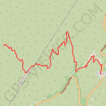
Hike to Chiquito Falls (or Lyon Canyon Falls) via San Juan Trail and Chiquito Trail in the Cleveland National Forest. #Hike #Falls #Nature #Mountain #Forest #River

  • Distance : 7,0 Km
  • Dénivelé positif : 342 m
  • Altitude maximum : 808 m
  • Dénivelé négatif : 211 m
  • Altitude minimum : 513 m

Carte interactive

Profil de la trace GPS

À propos de cette trace GPS

Autres traces GPS

Cliquez sur une trace GPS pour visualiser son itinéraire, ses statistiques et son profil.

Morgan Trail and Morrell Canyon

United States > California > Riverside County > Lake Elsinore

Hike from Ortega Oaks via the Bear Canyon, the Morgan Trail and the Morrell Canyon in the San Mateo Canyon Wilderness and the Cleveland National Forest. #Hike #Nature #Canyon #Mountain #Forest #Wilderness

Distance : 8,4 Km • Dénivelé positif : 349 m • Altitude maximum : 888 m