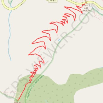
Importer un fichier GPX

Mount Baden Powell

Angeles National Forest. #Hike #Mountain #Forest #Nature

  • Distance : 12,8 Km
  • Dénivelé positif : 870 m
  • Altitude maximum : 2.855 m
  • Dénivelé négatif : 870 m
  • Altitude minimum : 2.014 m

Carte interactive

Profil de la trace GPS

À propos de cette trace GPS

Autres traces GPS

Cliquez sur une trace GPS pour visualiser son itinéraire, ses statistiques et son profil.

Mount Baden-Powell

United States > California > Los Angeles County

Hike from Vincent Gap to Mount Baden-Powell via the Pacific Crest Trail (PCT) in the San Gabriel Mountains National Monument and the Angeles National Forest. #Hike #Mountain #Nature #Forest #Angeles

Distance : 6,3 Km • Dénivelé positif : 857 m • Altitude maximum : 2.857 m

Big Horn Mine

United States > California > Los Angeles County

Hike from Vincent Gap to the Big Horn Abandoned Mine in the Sheep Mountain Wilderness and the Angeles National Forest. #Hike #Mountain #Nature #Forest #Angeles

Distance : 3,0 Km • Dénivelé positif : 224 m • Altitude maximum : 2.110 m