East Coast Trail - Father Troy Path
- Distance : 7,3 Km
- Dénivelé positif : 283 m
- Altitude maximum : 125 m
- Dénivelé négatif : 278 m
- Altitude minimum : 0 m
Carte interactive
Profil de la trace GPS
À propos de cette trace GPS
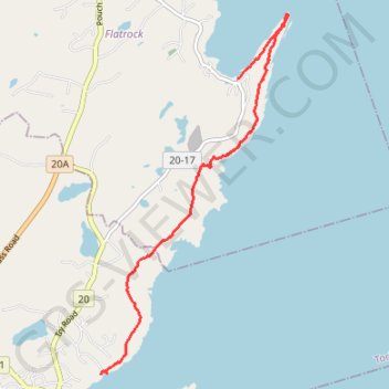
Nom : Trace GPS East Coast Trail - Father Troy Path, itinéraire, parcours
Coordonnées : 47.66532 -52.72737 47.70710 -52.69504
Autres traces GPS
Cliquez sur une trace GPS pour visualiser son itinéraire, ses statistiques et son profil.
East Coast Trail - Stiles Cove Path
Canada > Newfoundland and Labrador > Flatrock
Distance : 15,9 Km • Dénivelé positif : 882 m • Altitude maximum : 101 m