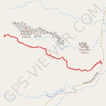
Cathedrals Trail
Hike along the Cathedrals Trail in the Cathedral Valley and the Capitol Reef National Park. #Hike #Nature #Park
- Distance : 4,0 Km
- Dénivelé positif : 126 m
- Altitude maximum : 2.049 m
- Dénivelé négatif : 126 m
- Altitude minimum : 1.949 m
- Temps en mouvement : 1 h 7 m
- Vitesse en mouvement : 3,5 Km/h
- Vitesse maximum : 3,8 Km/h
- Temps total : 1 h 7 m
- Vitesse globale : 3,5 Km/h
- Date : 08/03/24
Carte interactive
Profil de la trace GPS
À propos de cette trace GPS
Nom : Trace GPS Cathedrals Trail, itinéraire, parcours
Départ : Caineville Wash Road, Caineville, Wayne County, Utah, United States (38.48799 -111.35321)
Arrivée : Cathedrals Trail, Wayne County, Utah, United States (38.48797 -111.35325)
Coordonnées : 38.48694 -111.37030 38.49194 -111.35321