Josephine Peak
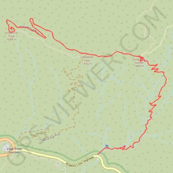
Hike to the Josephine Peak by the Colby Canyon, the Josephine Saddle and the Josephine Gap in the San Gabriel Mountains National Monument and the Angeles National Forest. #Hike #Mountain #Nature #Canyon #Forest #River #Angeles
- Distance : 6,7 Km
- Dénivelé positif : 677 m
- Altitude maximum : 1.667 m
- Dénivelé négatif : 85 m
- Altitude minimum : 1.072 m
Carte interactive
Profil de la trace GPS
À propos de cette trace GPS
Nom : Trace GPS Josephine Peak, itinéraire, parcours
Départ : Angeles Crest Highway, Los Angeles County, California, United States (34.26975 -118.14067)
Arrivée : Josephine Peak Summit Trail, Los Angeles County, California, United States (34.28561 -118.15390)
Coordonnées : 34.26975 -118.15467 34.28699 -118.13011