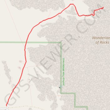
Willow Hole
Hike to Willow Hole by the Boy Scout Trail and the Willow Hole Trail via the Mustang Ranch, the Bear Island and the Wonderland of Rocks in the Joshua Tree National Park. #Hike #Nature #Rocks #Desert #Park
- Distance : 5,6 Km
- Dénivelé positif : 61 m
- Altitude maximum : 1.270 m
- Dénivelé négatif : 53 m
- Altitude minimum : 1.230 m
Carte interactive
Profil de la trace GPS
À propos de cette trace GPS
Nom : Trace GPS Willow Hole, itinéraire, parcours
Départ : Boy Scout Trail, San Bernardino County, California, United States (34.04111 -116.18574)
Coordonnées : 34.04111 -116.18580 34.06980 -116.15278
Autres traces GPS
Cliquez sur une trace GPS pour visualiser son itinéraire, ses statistiques et son profil.