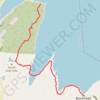
East Coast Trail - Deadmans Bay Path
- Distance : 10,0 Km
- Dénivelé positif : 440 m
- Altitude maximum : 220 m
- Dénivelé négatif : 451 m
- Altitude minimum : -1 m
Carte interactive
Profil de la trace GPS
À propos de cette trace GPS
Nom : Trace GPS East Coast Trail - Deadmans Bay Path, itinéraire, parcours
Coordonnées : 47.52551 -52.69837 47.56356 -52.65608
Autres traces GPS
Cliquez sur une trace GPS pour visualiser son itinéraire, ses statistiques et son profil.
Whitbourne - St. John's
Canada > Newfoundland and Labrador > Whitbourne
#Bike #Whitbourne #StJohns #Newfoundland #Atlantic
Distance : 103,3 Km • Dénivelé positif : 1.230 m • Altitude maximum : 234 m