Mallorytown - Arnold's Cove
#Bike #Mallorytown #ArnoldsCove #Newfoundland
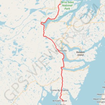
- Distance : 118,7 Km
- Dénivelé positif : 1.182 m
- Altitude maximum : 149 m
- Dénivelé négatif : 1.171 m
- Altitude minimum : 8 m
Carte interactive
Profil de la trace GPS
À propos de cette trace GPS
Nom : Trace GPS Mallorytown - Arnold's Cove, itinéraire, parcours
Départ : Newfoundland, Newfoundland and Labrador, Canada (48.54387 -53.97440)
Coordonnées : 47.75619 -54.20892 48.54387 -53.93189
Autres traces GPS
Cliquez sur une trace GPS pour visualiser son itinéraire, ses statistiques et son profil.
Arnold's Cove - Whitbourne
Canada > Newfoundland and Labrador
#Bike #ArnoldsCove #Whitbourne #Newfoundland
Distance : 50,5 Km • Dénivelé positif : 719 m • Altitude maximum : 199 m