The Golden Cathedral
Hike to The Golden Cathedral via Golden Cathedral Trail and Escalante River in the Glen Canyon National Recreation Area. #Hike #Nature #Canyon #Desert #Rock #River #Forest
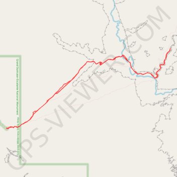
- Distance : 14,9 Km
- Dénivelé positif : 501 m
- Altitude maximum : 1.719 m
- Dénivelé négatif : 501 m
- Altitude minimum : 1.389 m
- Temps en mouvement : 2 h 1 m
- Vitesse en mouvement : 7,4 Km/h
- Vitesse maximum : 35,9 Km/h
- Temps total : 2 h 1 m
- Vitesse globale : 7,4 Km/h
- Date : 09/03/24
Carte interactive
Profil de la trace GPS
À propos de cette trace GPS
Nom : Trace GPS The Golden Cathedral, itinéraire, parcours
Départ : Golden Cathedral Trailhead, Egypt Road, Garfield County, Utah, United States (37.59334 -111.21831)
Arrivée : Golden Cathedral Trailhead, Egypt Road, Garfield County, Utah, United States (37.59338 -111.21833)
Coordonnées : 37.59319 -111.21834 37.61469 -111.16299