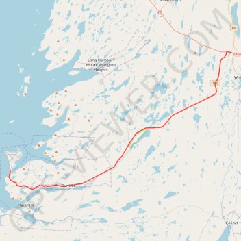
Argentia - Whitbourne
- Distance : 45,9 Km
- Dénivelé positif : 453 m
- Altitude maximum : 183 m
- Dénivelé négatif : 401 m
- Altitude minimum : 0 m
Carte interactive
Profil de la trace GPS
À propos de cette trace GPS
Nom : Trace GPS Argentia - Whitbourne, itinéraire, parcours
Départ : Charter Avenue, Placentia, Newfoundland, Newfoundland and Labrador, Canada (47.28924 -53.99347)
Coordonnées : 47.26436 -53.99626 47.45021 -53.55219
Autres traces GPS
Cliquez sur une trace GPS pour visualiser son itinéraire, ses statistiques et son profil.
Whitbourne - St. John's
Canada > Newfoundland and Labrador > Whitbourne
#Bike #Whitbourne #StJohns #Newfoundland #Atlantic
Distance : 103,3 Km • Dénivelé positif : 1.230 m • Altitude maximum : 234 m
Arnold's Cove - Whitbourne
Canada > Newfoundland and Labrador
#Bike #ArnoldsCove #Whitbourne #Newfoundland
Distance : 50,5 Km • Dénivelé positif : 719 m • Altitude maximum : 199 m