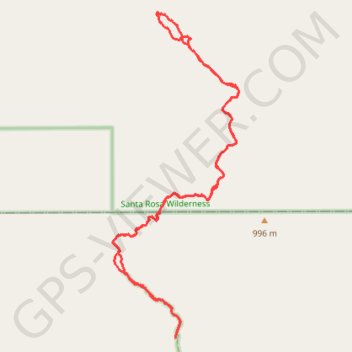
Borrego Springs - Rockhouse Canyon
Hike through the Rockhouse Canyon to the Cottonwood Springs via Rockhouse Trail, Hidden Springs, in the Santa Rosa Wilderness and the Anza-Borrego Desert State Park. #Hike #Loop #Mountain #Canyon #Nature #Desert #Wilderness #Park
- Distance : 21,5 Km
- Dénivelé positif : 645 m
- Altitude maximum : 956 m
- Dénivelé négatif : 645 m
- Altitude minimum : 496 m
- Temps en mouvement : 5 h 7 m
- Vitesse en mouvement : 4,2 Km/h
- Vitesse maximum : 68,9 Km/h
- Temps total : 5 h 31 m
- Vitesse globale : 3,9 Km/h
- Date : 29/03/12
Carte interactive
Profil de la trace GPS
À propos de cette trace GPS
Nom : Trace GPS Borrego Springs - Rockhouse Canyon, itinéraire, parcours
Départ : Rockhouse Trail, San Diego County, California, United States (33.40587 -116.37535)
Arrivée : Rockhouse Trail, San Diego County, California, United States (33.40588 -116.37532)
Coordonnées : 33.40587 -116.38811 33.46122 -116.36234