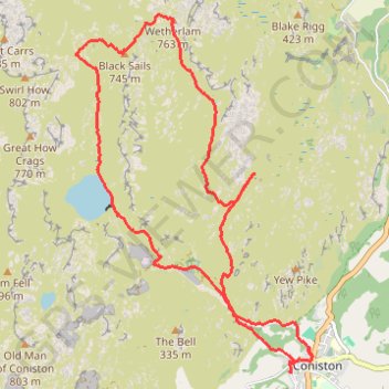
Wetherlam and Black Sails Loop
Loop hike from Coniston via Coniston Waterfall, Hole Rake, Lower Hows, Wetherlam, Red Dell Head Moss, Black Sails and Levers Water in the Lake District National Park. #Hike #Loop #Nature #Mountain #Lake
- Distance : 13,6 Km
- Dénivelé positif : 758 m
- Altitude maximum : 757 m
- Dénivelé négatif : 759 m
- Altitude minimum : 60 m
- Temps en mouvement : 5 h 4 m
- Vitesse en mouvement : 2,7 Km/h
- Vitesse maximum : 6,9 Km/h
- Temps total : 6 h 43 m
- Vitesse globale : 2,0 Km/h
- Date : 02/04/24
Carte interactive
Profil de la trace GPS
À propos de cette trace GPS
Nom : Trace GPS Wetherlam and Black Sails Loop, itinéraire, parcours
Coordonnées : 54.36777 -3.11351 54.40093 -3.07580