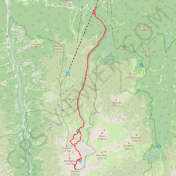
Musala peak, the highest of Bulgaria (and the whole Balkan)
- Distance : 25,5 Km
- Dénivelé positif : 1.558 m
- Altitude maximum : 2.921 m
- Dénivelé négatif : 1.558 m
- Altitude minimum : 1.410 m
Carte interactive
Profil de la trace GPS
À propos de cette trace GPS
Nom : Trace GPS Musala peak, the highest of Bulgaria (and the whole Balkan), itinéraire, parcours
Départ : SFO1570, Borovets, Samokov, Sofia, 2010, Bulgaria (42.25689 23.59721)
Arrivée : SFO1570, Borovets, Samokov, Sofia, 2010, Bulgaria (42.25691 23.59718)
Coordonnées : 42.17874 23.58169 42.25868 23.60595