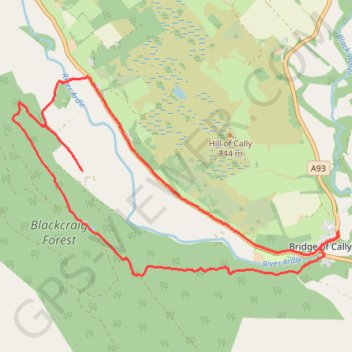
Around Bridge of Cally
- Distance : 13,3 Km
- Dénivelé positif : 282 m
- Altitude maximum : 293 m
- Dénivelé négatif : 282 m
- Altitude minimum : 157 m
- Temps en mouvement : 59 m 19 s
- Vitesse en mouvement : 13,5 Km/h
- Vitesse maximum : 32,3 Km/h
- Temps total : 1 h 30 m
- Vitesse globale : 8,8 Km/h
- Date : 27/04/24
Carte interactive
Profil de la trace GPS
À propos de cette trace GPS
Nom : Trace GPS Around Bridge of Cally, itinéraire, parcours
Coordonnées : 56.64380 -3.46759 56.66628 -3.40078
Autres traces GPS
Cliquez sur une trace GPS pour visualiser son itinéraire, ses statistiques et son profil.
Spittal of Glenshee to Alyth - Some of the Cateran Trail
United Kingdom > Scotland > Perth and Kinross > Spittal of Glenshee
Distance : 38,3 Km • Dénivelé positif : 561 m • Altitude maximum : 459 m
Alyth to Spittal of Glenshee - Cateran Trail (some of)
United Kingdom > Scotland > Perth and Kinross > Alyth
Distance : 44,2 Km • Dénivelé positif : 1.134 m • Altitude maximum : 650 m